
Puente Nacional topographic map
Interactive map
Click on the map to display elevation.
About this map
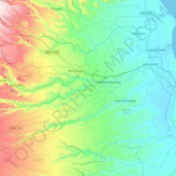
Name: Puente Nacional topographic map, elevation, terrain.
Location: Puente Nacional, Veracruz, 91653, Mexico (19.18855 -96.81893 19.43828 -96.37226)
Average elevation: 236 m
Minimum elevation: 0 m
Maximum elevation: 908 m