
Telagh topographic map
Interactive map
Click on the map to display elevation.
About this map
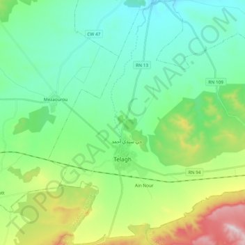
Name: Telagh topographic map, elevation, terrain.
Location: Telagh, Telagh District, Sidi Bel Abbès, Algeria (34.72531 -0.62911 34.88041 -0.44178)
Average elevation: 902 m
Minimum elevation: 732 m
Maximum elevation: 1,389 m