
Queguas topographic map
Interactive map
Click on the map to display elevation.
About this map
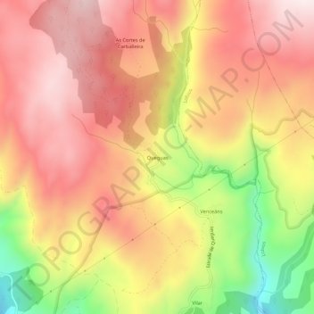
Name: Queguas topographic map, elevation, terrain.
Average elevation: 917 m
Minimum elevation: 528 m
Maximum elevation: 1,161 m
Other topographic maps
Click on a map to view its topography, its elevation and its terrain.
As Grallas do Quinxo
Espagne > Galice > A Baixa Limia > Entrimo
As Grallas do Quinxo, A Illa, Entrimo, A Baixa Limia, Ourense, Galice, 32869, Espagne
Average elevation: 804 m