
Clungunford topographic map
Interactive map
Click on the map to display elevation.
About this map
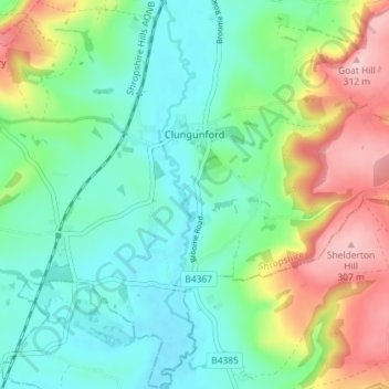
Name: Clungunford topographic map, elevation, terrain.
Average elevation: 180 m
Minimum elevation: 120 m
Maximum elevation: 309 m
Clungunford lies at an elevation of between 130m and 145m above sea level.