
Thank you for supporting this site ❤️
Make a donation
Make a donation
Gear up for your next adventure:
As an Amazon Associate, this site earns from qualifying purchases at no extra cost to you.
Ivanivka topographic map
Click on the map to display elevation.
Thank you for supporting this site ❤️
Make a donation
Make a donation
Gear up for your next adventure:
As an Amazon Associate, this site earns from qualifying purchases at no extra cost to you.
About this map
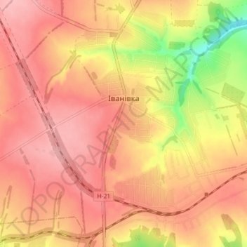
Name: Ivanivka topographic map, elevation, terrain.
Location: Ivanivka, Antratsyt Raion, Luhansk Oblast, 94644, Ukraine (48.20938 38.92319 48.25657 38.98172)
Average elevation: 325 m
Minimum elevation: 246 m
Maximum elevation: 362 m
Thank you for supporting this site ❤️
Make a donation
Make a donation
Gear up for your next adventure:
As an Amazon Associate, this site earns from qualifying purchases at no extra cost to you.