
Featherstone topographic map
Click on the map to display elevation.
About this map
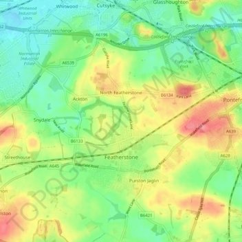
Name: Featherstone topographic map, elevation, terrain.
Average elevation: 47 m
Minimum elevation: 15 m
Maximum elevation: 89 m
England trails, hiking, mountain biking, running and outdoor activities
Other topographic maps
Click on a map to view its topography, its elevation and its terrain.
Hemsworth Water Park
United Kingdom > England > Wakefield > Hemsworth > Kinsley
Average elevation: 60 m
Featherstone Colliery
United Kingdom > England > Wakefield > Featherstone > Snydale
Average elevation: 44 m