Geolocate

Coloma topographic map

Click on the map to display elevation.

About this map

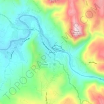
Name: Coloma topographic map, elevation, terrain.

Location: Coloma, El Dorado County, California, 95613, United States (38.77990 -120.91022 38.81990 -120.87022)

Average elevation: 341 m

Minimum elevation: 212 m

Maximum elevation: 587 m

Gear up for your next adventure:

🥾Men's Waterproof Hiking Boots - Durable footwear with deep lugs for muddy and rocky UK terrains
🪢Paracord - Multi-purpose cord for camping and survival
🥾Hiking Boot Waterproofing Wax - Maintain the lifespan of your leather trekking boots
🛰️Satellite Messengers - Emergency communication devices for areas without mobile signal
🥾Walking Shoes - Lightweight walking shoes for countryside and coastal paths

As an Amazon Associate, this site earns from qualifying purchases at no extra cost to you.