
Castro de Rei topographic map
Interactive map
Click on the map to display elevation.
About this map
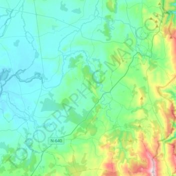
Name: Castro de Rei topographic map, elevation, terrain.
Location: Castro de Rei, Terra Chá, Lugo, Galice, Espagne (43.06769 -7.56114 43.28280 -7.34695)
Average elevation: 505 m
Minimum elevation: 388 m
Maximum elevation: 1,023 m