
Sorag topographic map
Interactive map
Click on the map to display elevation.
About this map
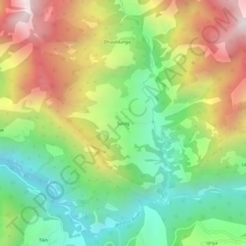
Name: Sorag topographic map, elevation, terrain.
Location: Sorag, Kapkot, Bageshwar, Uttarakhand, India (30.08424 79.85970 30.12424 79.89970)
Average elevation: 2,371 m
Minimum elevation: 1,782 m
Maximum elevation: 3,189 m