
Thank you for supporting this site ❤️
Make a donation
Make a donation
Gear up for your next adventure:
As an Amazon Associate, this site earns from qualifying purchases at no extra cost to you.
Zacatal topographic map
Click on the map to display elevation.
Thank you for supporting this site ❤️
Make a donation
Make a donation
Gear up for your next adventure:
As an Amazon Associate, this site earns from qualifying purchases at no extra cost to you.
About this map
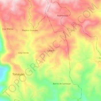
Name: Zacatal topographic map, elevation, terrain.
Location: Zacatal, Tonayán, Veracruz, 91400, México (19.67278 -96.92750 19.71278 -96.88750)
Average elevation: 1,816 m
Minimum elevation: 1,568 m
Maximum elevation: 1,987 m
Thank you for supporting this site ❤️
Make a donation
Make a donation
Gear up for your next adventure:
As an Amazon Associate, this site earns from qualifying purchases at no extra cost to you.