
Shuru topographic map
Interactive map
Click on the map to display elevation.
About this map
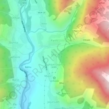
Name: Shuru topographic map, elevation, terrain.
Location: Shuru, Manali, Kullu, Himachal Pradesh, 175143, India (32.19704 77.18239 32.23704 77.22239)
Average elevation: 2,139 m
Minimum elevation: 1,694 m
Maximum elevation: 2,980 m