
Bernbeuren topographic map
Interactive map
Click on the map to display elevation.
About this map
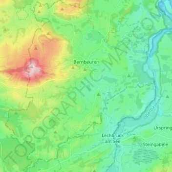
Name: Bernbeuren topographic map, elevation, terrain.
Average elevation: 789 m
Minimum elevation: 694 m
Maximum elevation: 1,047 m
Other topographic maps
Click on a map to view its topography, its elevation and its terrain.
Ellensberg
Germany > Bavaria > Landkreis Weilheim-Schongau > Bernbeuren
Ellensberg, Bernbeuren, Bernbeuren (VGem), Landkreis Weilheim-Schongau, Bavaria, 86975, Germany
Average elevation: 822 m
Bürstenstiel
Germany > Bavaria > Landkreis Weilheim-Schongau > Bernbeuren > Bürstenstiel
Bürstenstiel, Bernbeuren, Bernbeuren (VGem), Landkreis Weilheim-Schongau, Bavaria, 86975, Germany
Average elevation: 802 m