
陇川县 (Longchuan) topographic map
Interactive map
Click on the map to display elevation.
About this map
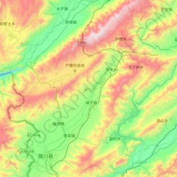
Name: 陇川县 (Longchuan) topographic map, elevation, terrain.
Location: 陇川县 (Longchuan), 德宏州, Yunnan, 665000, China (24.13770 97.65890 24.65434 98.28645)
Average elevation: 1,291 m
Minimum elevation: 641 m
Maximum elevation: 2,603 m
Other topographic maps
Click on a map to view its topography, its elevation and its terrain.