
Đồng Văn Town topographic map
Interactive map
Click on the map to display elevation.
About this map
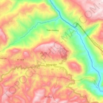
Name: Đồng Văn Town topographic map, elevation, terrain.
Location: Đồng Văn Town, Đồng Văn District, Hà Giang Province, Vietnam (23.25928 105.30993 23.32021 105.40796)
Average elevation: 1,081 m
Minimum elevation: 449 m
Maximum elevation: 1,622 m
Other topographic maps
Click on a map to view its topography, its elevation and its terrain.
Lũng Hoà B
Vietnam > Ha Giang province > Đồng Văn District > Sà Phìn Commune
Average elevation: 1,496 m