
Kechnec topographic map
Interactive map
Click on the map to display elevation.
Kechnec
The village lies at an altitude of 180 metres and covers an area of 10.211 km2. The municipality is part of the administrative units Košice-okolie District and Košice Region. It has a population of about 1080 people.
About this map
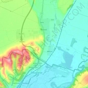
Name: Kechnec topographic map, elevation, terrain.
Average elevation: 188 m
Minimum elevation: 154 m
Maximum elevation: 281 m
Other topographic maps
Click on a map to view its topography, its elevation and its terrain.