
Campo de Montiel topographic map
Interactive map
Click on the map to display elevation.
About this map
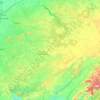
Name: Campo de Montiel topographic map, elevation, terrain.
Location: Campo de Montiel, Castile-La Mancha, Spain (38.40826 -3.45400 39.09889 -2.63649)
Average elevation: 857 m
Minimum elevation: 551 m
Maximum elevation: 1,742 m
Other topographic maps
Click on a map to view its topography, its elevation and its terrain.