Geolocate

Vestiena topographic map

Click on the map to display elevation.

About this map

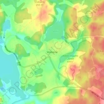
Name: Vestiena topographic map, elevation, terrain.

Location: Vestiena, Madonas novads, Vidzeme, Latvia (56.84570 25.84954 56.88570 25.88954)

Average elevation: 221 m

Minimum elevation: 187 m

Maximum elevation: 262 m

Gear up for your next adventure:

🧥Softshell Jackets - Breathable jackets for active outdoor use
🍲Portable Camping Stoves - Fast-boiling stoves for hot meals on remote topographic survey trips
🎒Hiking Daypacks - Compact backpacks ideal for short hikes and excursions
🧣Neck Gaiters - Versatile protection against wind and cold
🧢Hiking Hats - Sun and weather protection for outdoor walks

As an Amazon Associate, this site earns from qualifying purchases at no extra cost to you.