Geolocate

Roblin topographic map

Click on the map to display elevation.

About this map

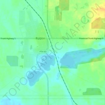
Name: Roblin topographic map, elevation, terrain.

Location: Roblin, Municipality of Roblin, Manitoba, R0L 1P0, Canada (51.21359 -101.37531 51.23554 -101.33460)

Average elevation: 553 m

Minimum elevation: 542 m

Maximum elevation: 571 m

Gear up for your next adventure:

📢Survival Whistles - Essential safety gear for signaling for help in mountain fog
🗺️Topographic Maps - Detailed maps showing elevation and terrain features
📷Outdoor Action Cameras - Cameras designed for hiking and adventure
🥾Walking Shoes - Lightweight walking shoes for countryside and coastal paths
🦯Walking Poles - Supportive poles for long-distance walking

As an Amazon Associate, this site earns from qualifying purchases at no extra cost to you.