
Ölgii topographic map
Interactive map
Click on the map to display elevation.
About this map
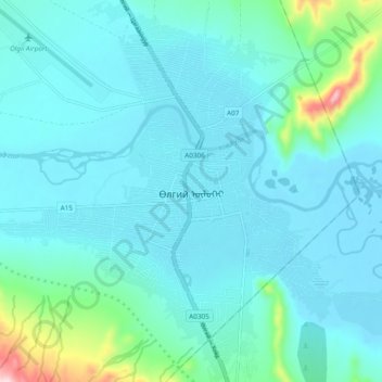
Name: Ölgii topographic map, elevation, terrain.
Location: Ölgii, Olgii, Bayan-Ölgii, 83120, Mongolia (48.93737 89.91216 48.99975 89.99761)
Average elevation: 1,750 m
Minimum elevation: 1,708 m
Maximum elevation: 2,034 m
Ölgii (Oirat: Өлгий, Mongolian: [ɵɮˈɟi(ː)]; Kazakh: Өлке / Ölke, [ɵlˈce]) is the capital of the Bayan-Ölgii Aimag (province) of Mongolia, located in the extreme west of the country. It lies on an altitude of 1,710 meters (5,610 feet). As of 2014 it had a population of 30,338 people.[1]
Other topographic maps
Click on a map to view its topography, its elevation and its terrain.
Ölgii
Mongolia > Bayan-Ölgii > Olgii > Ölgii
Ölgii, Olgii, Bayan-Ölgii, 83120, Mongolia
Average elevation: 2,063 m