Geolocate

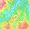
Aldeia da Ribeira topographic map

Click on the map to display elevation.

About this map

Name: Aldeia da Ribeira topographic map, elevation, terrain.

Location: Aldeia da Ribeira, Aldeia da Ribeira, Vilar Maior e Badamalos, Sabugal, Guarda, Portugal (40.43435 -6.94413 40.49152 -6.83317)

Average elevation: 816 m

Minimum elevation: 737 m

Maximum elevation: 885 m

Other topographic maps

Click on a map to view its topography, its elevation and its terrain.
Gear up for your next adventure:

🥤Collapsible Water Bottles - Save space in your rucksack as you consume your water
🧢Thermal Beanie Hats - Prevent heat loss from the head in windy summit conditions
🦯Walking Poles - Supportive poles for long-distance walking
🥾Men's Waterproof Hiking Boots - Durable footwear with deep lugs for muddy and rocky UK terrains
🩹Hiking First Aid Kits - Compact medical kits tailored for trail injuries and emergencies

As an Amazon Associate, this site earns from qualifying purchases at no extra cost to you.