
Motueka topographic map
Interactive map
Click on the map to display elevation.
About this map
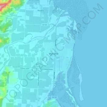
Name: Motueka topographic map, elevation, terrain.
Location: Motueka, Tasman, 7143, Neuseeland (-41.15249 172.96949 -41.07249 173.04949)
Average elevation: 12 m
Minimum elevation: -3 m
Maximum elevation: 262 m
Other topographic maps
Click on a map to view its topography, its elevation and its terrain.