
Bhilwara topographic map
Interactive map
Click on the map to display elevation.
About this map
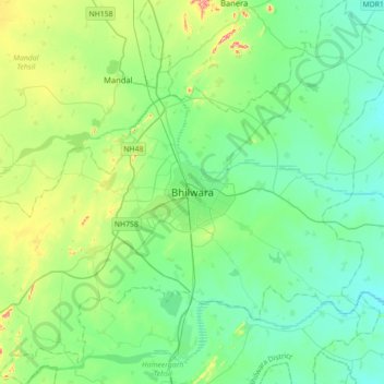
Name: Bhilwara topographic map, elevation, terrain.
Location: Bhilwara, Bhilwara Tehsil, Bhilwara, Rajasthan, 311001, India (25.18800 74.47600 25.50800 74.79600)
Average elevation: 426 m
Minimum elevation: 379 m
Maximum elevation: 586 m
Other topographic maps
Click on a map to view its topography, its elevation and its terrain.
Sanganer
India > Rajasthan > Bhilwara Tehsil
Sanganer, Bhilwara Tehsil, Bhilwara District, Rajasthan, 311011, India
Average elevation: 412 m