
Thank you for supporting this site ❤️
Make a donation
Make a donation
Gear up for your next adventure:
As an Amazon Associate, this site earns from qualifying purchases at no extra cost to you.
Kendri topographic map
Click on the map to display elevation.
Thank you for supporting this site ❤️
Make a donation
Make a donation
Gear up for your next adventure:
As an Amazon Associate, this site earns from qualifying purchases at no extra cost to you.
About this map
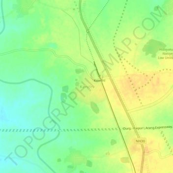
Name: Kendri topographic map, elevation, terrain.
Location: Kendri, Abhanpur Tahsil, Raipur, Chhattisgarh, 490002, India (21.07963 81.71798 21.11963 81.75798)
Average elevation: 314 m
Minimum elevation: 299 m
Maximum elevation: 327 m
Thank you for supporting this site ❤️
Make a donation
Make a donation
Gear up for your next adventure:
As an Amazon Associate, this site earns from qualifying purchases at no extra cost to you.