
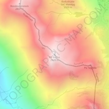
Piz Badus topographic map
Interactive map
Click on the map to display elevation.
About this map
Name: Piz Badus topographic map, elevation, terrain.
Location: Piz Badus, Andermatt, Korporation Ursern, Uri, 6490, Zwitserland (46.62250 8.66353 46.62260 8.66363)
Average elevation: 2,410 m
Minimum elevation: 1,684 m
Maximum elevation: 2,887 m