
Alexandrov topographic map
Interactive map
Click on the map to display elevation.
About this map
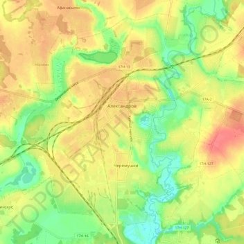
Name: Alexandrov topographic map, elevation, terrain.
Average elevation: 181 m
Minimum elevation: 151 m
Maximum elevation: 207 m
Other topographic maps
Click on a map to view its topography, its elevation and its terrain.
Alexandrov
Russia > Vladimir Oblast > Alexandrovsky District > Alexandrov
Alexandrov, городское поселение Александров, Alexandrovsky District, Vladimir Oblast, Central Federal District, 601654, Russia
Average elevation: 183 m