
Thank you for supporting this site ❤️
Make a donation
Make a donation
Gear up for your next adventure:
As an Amazon Associate, this site earns from qualifying purchases at no extra cost to you.
Maco topographic map
Click on the map to display elevation.
Thank you for supporting this site ❤️
Make a donation
Make a donation
Gear up for your next adventure:
As an Amazon Associate, this site earns from qualifying purchases at no extra cost to you.
About this map
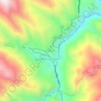
Name: Maco topographic map, elevation, terrain.
Location: Maco, Tapo, Province of Tarma, Junín, Peru (-11.50780 -75.57062 -11.46780 -75.53062)
Average elevation: 3,806 m
Minimum elevation: 3,377 m
Maximum elevation: 4,329 m
Thank you for supporting this site ❤️
Make a donation
Make a donation
Gear up for your next adventure:
As an Amazon Associate, this site earns from qualifying purchases at no extra cost to you.