
Cahora-Bassa topographic map
Interactive map
Click on the map to display elevation.
About this map
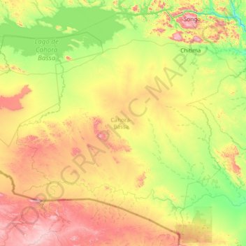
Name: Cahora-Bassa topographic map, elevation, terrain.
Location: Cahora-Bassa, Tete Province, Mozambique (-16.60619 31.92046 -15.55313 33.11235)
Average elevation: 481 m
Minimum elevation: 164 m
Maximum elevation: 1,120 m
The climate is predominantly hot semi-arid modified locally by altitude, with two distinct seasons, the rainy season (very short) and the dry season (very long). The average annual precipitation is about 635 mm, while annual potential evapotranspiration is about 1623 mm. Most rainfall occurs mainly in the period between December and February, varying significantly in quantitade and distribution from year to year. The average annual temperature is 26 °C.