
Thank you for supporting this site ❤️
Make a donation
Make a donation
Gear up for your next adventure:
As an Amazon Associate, this site earns from qualifying purchases at no extra cost to you.
Gette topographic map
Click on the map to display elevation.
Thank you for supporting this site ❤️
Make a donation
Make a donation
Gear up for your next adventure:
As an Amazon Associate, this site earns from qualifying purchases at no extra cost to you.
About this map
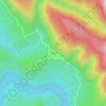
Name: Gette topographic map, elevation, terrain.
Location: Gette, Yingkiong Circle, Upper Siang, Arunachal Pradesh, Inde (28.66631 94.98897 28.70631 95.02897)
Average elevation: 667 m
Minimum elevation: 263 m
Maximum elevation: 1,391 m
Thank you for supporting this site ❤️
Make a donation
Make a donation
Gear up for your next adventure:
As an Amazon Associate, this site earns from qualifying purchases at no extra cost to you.