
Boortmeerbeek topographic map
Interactive map
Click on the map to display elevation.
About this map
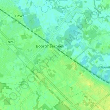
Name: Boortmeerbeek topographic map, elevation, terrain.
Location: Boortmeerbeek, Louvain, Brabant flamand, Flandre, 3190, Belgique (50.95822 4.55130 50.99840 4.61287)
Average elevation: 9 m
Minimum elevation: 2 m
Maximum elevation: 17 m