
2e Acul des Pins topographic map
Interactive map
Click on the map to display elevation.
About this map
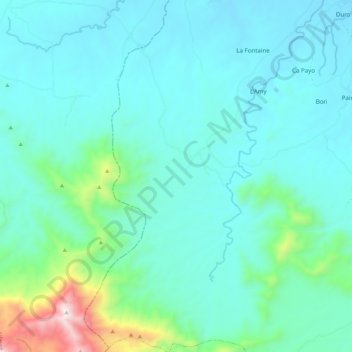
Name: 2e Acul des Pins topographic map, elevation, terrain.
Average elevation: 203 m
Minimum elevation: 36 m
Maximum elevation: 1,088 m
Other topographic maps
Click on a map to view its topography, its elevation and its terrain.
1re Haut Maribahoux
Haiti > Nord-Est Department > Commune Ouanaminthe
1re Haut Maribahoux, Commune Ouanaminthe, Arrondissement Ouanaminthe, Nord-Est Department, Haiti
Average elevation: 41 m