
Escalá topographic map
Interactive map
Click on the map to display elevation.
About this map
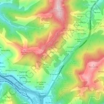
Name: Escalá topographic map, elevation, terrain.
Location: Escalá, Mieres, Asturies, 33618, Espagne (43.25913 -5.79730 43.29913 -5.75730)
Average elevation: 407 m
Minimum elevation: 182 m
Maximum elevation: 703 m