Geolocate

Center topographic map

Click on the map to display elevation.

About this map

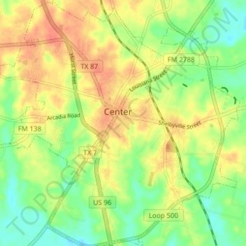
Name: Center topographic map, elevation, terrain.

Location: Center, Shelby County, Texas, 75935, United States (31.76645 -94.21010 31.81895 -94.14955)

Average elevation: 99 m

Minimum elevation: 75 m

Maximum elevation: 120 m

Other topographic maps

Click on a map to view its topography, its elevation and its terrain.

Mount Herman

United States > Texas > Shelby County

Average elevation: 124 m

Gear up for your next adventure:

🪓Outdoor Multitools - Versatile tools for hiking and camping
🛰️Satellite Messengers - Emergency communication devices for areas without mobile signal
🧼Technical Clothing Wash - Special soap to clean and restore waterproof membranes
🔋Solar Chargers - Eco-friendly charging solutions for outdoor use
💧Hydration Reservoirs - Convenient water bladders for hands-free drinking on the move

As an Amazon Associate, this site earns from qualifying purchases at no extra cost to you.