Geolocate

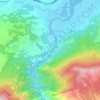
Rashche topographic map

Click on the map to display elevation.

About this map

Name: Rashche topographic map, elevation, terrain.

Location: Rashche, Municipality of Saraj, City of Skopje, North Macedonia (41.99414 21.20383 42.06418 21.29858)

Average elevation: 534 m

Minimum elevation: 277 m

Maximum elevation: 1,259 m

Other topographic maps

Click on a map to view its topography, its elevation and its terrain.
Dolna Matka

North Macedonia > City of Skopje

Average elevation: 504 m

Ѓафа

North Macedonia > City of Skopje > Strachinci

Average elevation: 899 m

Gear up for your next adventure:

🧘Folding Sit Mats - Dry and warm seat for map-reading breaks on damp ground
🐕Dog Hiking Gear - Equipment for hiking safely with dogs
🌄Outdoor Binoculars - Compact binoculars for landscape observation
🔥Reusable Hand Warmers - Maintain dexterity in your fingers for precise map handling
🧭GPS Trackers - Tracking devices for safety and navigation

As an Amazon Associate, this site earns from qualifying purchases at no extra cost to you.