
Kuujjuaq (Village) topographic map
Interactive map
Click on the map to display elevation.
About this map
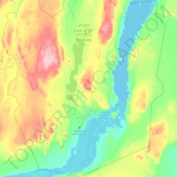
Name: Kuujjuaq (Village) topographic map, elevation, terrain.
Location: Kuujjuaq (Village), Kativik, Nord-du-Québec, Quebec, Canada (58.02119 -68.53671 58.26798 -68.22299)
Average elevation: 64 m
Minimum elevation: -1 m
Maximum elevation: 188 m
Other topographic maps
Click on a map to view its topography, its elevation and its terrain.
Pingualuit Crater
Canada > Quebec > Kativik > Rivière-Koksoak
Pingualuit Crater, Rivière-Koksoak, Kativik, Northern Quebec, Quebec, Canada
Average elevation: 538 m
Kuujjuarapik (Village)
Canada > Quebec > Kativik > Kuujjuarapik (Village)
Kuujjuarapik (Village), Kativik, Northern Quebec, Quebec, Canada
Average elevation: 18 m