
Grass topographic map
Interactive map
Click on the map to display elevation.
About this map
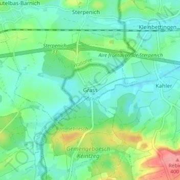
Name: Grass topographic map, elevation, terrain.
Location: Grass, Steinfort, Canton Capellen, 8362, Luxemburg (49.61062 5.87240 49.65062 5.91240)
Average elevation: 332 m
Minimum elevation: 307 m
Maximum elevation: 403 m