
Make a donation
Gear up for your next adventure:
As an Amazon Associate, this site earns from qualifying purchases at no extra cost to you.
Sondernach topographic map
Click on the map to display elevation.
Make a donation
Gear up for your next adventure:
As an Amazon Associate, this site earns from qualifying purchases at no extra cost to you.
Sondernach
Village situé dans le parc naturel régional des Ballons des Vosges, Sondernach partage avec Mittlach le privilège d'être situé à l'amont d'une grande vallée arrosée par l'un des ruisseaux formant la Fecht. L'altitude du centre est comprise entre 500 et 600 mètres. Sa seule voisine immédiate est la commune de Metzeral au nord.
Make a donation
Gear up for your next adventure:
As an Amazon Associate, this site earns from qualifying purchases at no extra cost to you.
About this map
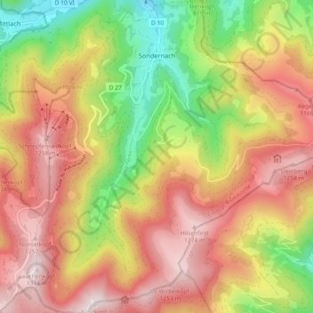
Name: Sondernach topographic map, elevation, terrain.
Average elevation: 931 m
Minimum elevation: 494 m
Maximum elevation: 1,314 m
Make a donation
Gear up for your next adventure:
As an Amazon Associate, this site earns from qualifying purchases at no extra cost to you.