
Thank you for supporting this site ❤️
Make a donation
Make a donation
Gear up for your next adventure:
As an Amazon Associate, this site earns from qualifying purchases at no extra cost to you.
Soavina topographic map
Click on the map to display elevation.
Thank you for supporting this site ❤️
Make a donation
Make a donation
Gear up for your next adventure:
As an Amazon Associate, this site earns from qualifying purchases at no extra cost to you.
About this map
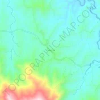
Name: Soavina topographic map, elevation, terrain.
Location: Soavina, Vakinankaratra, Province d’Antananarivo, Madagascar (-19.81540 46.71357 -19.77540 46.75357)
Average elevation: 1,311 m
Minimum elevation: 1,207 m
Maximum elevation: 1,649 m
Thank you for supporting this site ❤️
Make a donation
Make a donation
Gear up for your next adventure:
As an Amazon Associate, this site earns from qualifying purchases at no extra cost to you.