
Thank you for supporting this site ❤️
Make a donation
Make a donation
Gear up for your next adventure:
As an Amazon Associate, this site earns from qualifying purchases at no extra cost to you.
Itremo topographic map
Click on the map to display elevation.
Thank you for supporting this site ❤️
Make a donation
Make a donation
Gear up for your next adventure:
As an Amazon Associate, this site earns from qualifying purchases at no extra cost to you.
About this map
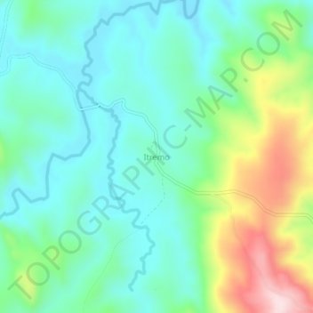
Name: Itremo topographic map, elevation, terrain.
Location: Itremo, Amoron'i Mania, Province de Fianarantsoa, Madagascar (-20.61389 46.61705 -20.57389 46.65705)
Average elevation: 1,384 m
Minimum elevation: 1,287 m
Maximum elevation: 1,639 m
Thank you for supporting this site ❤️
Make a donation
Make a donation
Gear up for your next adventure:
As an Amazon Associate, this site earns from qualifying purchases at no extra cost to you.