
Potosí topographic map
Interactive map
Click on the map to display elevation.
Potosí
Potosí liegt zwischen 3.976 m und 4.070 m Seehöhe auf der Hochebene des Altiplano, in einer kargen, steppenhaften Gegend. Die Stadt gehört zu den höchstgelegenen Großstädten der Welt. Die Stadt ist zentraler Ort des Landkreises (bolivianisch: Municipio) Potosí in der Provinz Tomás Frías.
About this map
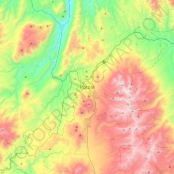
Name: Potosí topographic map, elevation, terrain.
Location: Potosí, Provincia Tomás Frías, Potosí, 39, Bolivien (-19.74931 -65.91348 -19.42931 -65.59348)
Average elevation: 4,054 m
Minimum elevation: 3,300 m
Maximum elevation: 5,016 m