
Differten topographic map
Interactive map
Click on the map to display elevation.
About this map
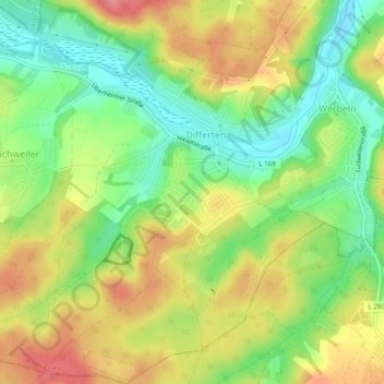
Name: Differten topographic map, elevation, terrain.
Location: Differten, Wadgassen, Landkreis Saarlouis, Saarland, Deutschland (49.22281 6.75586 49.25436 6.79543)
Average elevation: 224 m
Minimum elevation: 182 m
Maximum elevation: 270 m
Other topographic maps
Click on a map to view its topography, its elevation and its terrain.
Friedrichweiler
Deutschland > Saarland > Landkreis Saarlouis > Wadgassen
Friedrichweiler, Wadgassen, Landkreis Saarlouis, Saarland, Deutschland
Average elevation: 230 m