
Lembongan topographic map
Interactive map
Click on the map to display elevation.
About this map
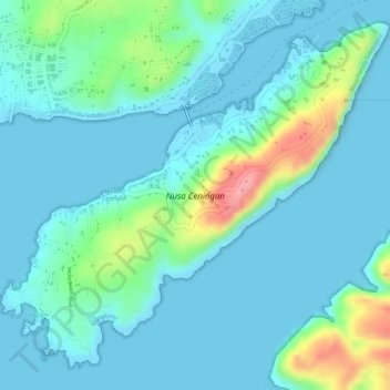
Name: Lembongan topographic map, elevation, terrain.
Location: Lembongan, Bali, Indonesia (-8.71247 115.43695 -8.68709 115.46581)
Average elevation: 23 m
Minimum elevation: -1 m
Maximum elevation: 116 m
Other topographic maps
Click on a map to view its topography, its elevation and its terrain.
Dauh Puri Kangin
Indonesia > Bali > Denpasar > Dauh Puri Kangin
Dauh Puri Kangin, Denpasar Barat, Denpasar, Bali, 80232, Indonesia
Average elevation: 26 m
Semarapura Kelod
Indonesia > Bali > Semarapura Kelod
Semarapura Kelod, Bali, Indonesia
Average elevation: 80 m