
Ellettsville topographic map
Interactive map
Click on the map to display elevation.
About this map
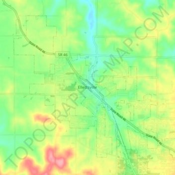
Name: Ellettsville topographic map, elevation, terrain.
Location: Ellettsville, Monroe County, Indiana, United States (39.20808 -86.65918 39.25968 -86.57832)
Average elevation: 235 m
Minimum elevation: 193 m
Maximum elevation: 296 m