Geolocate

Boja topographic map

Click on the map to display elevation.

About this map

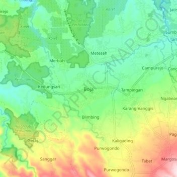
Name: Boja topographic map, elevation, terrain.

Location: Boja, Kendal, Central Java, Java, 51381, Indonesia (-7.14432 110.22670 -7.06432 110.30670)

Average elevation: 321 m

Minimum elevation: 196 m

Maximum elevation: 562 m

Gear up for your next adventure:

🌂Windproof Trekking Umbrellas - Surprising but effective rain protection on low-wind trails
🔪Outdoor Multi-Tools - Versatile tools for gear repairs and food prep in the wild
🥤Collapsible Water Bottles - Save space in your rucksack as you consume your water
🛌Insulated Sleeping Mats - Crucial thermal protection when sleeping on cold, uneven ground
🥾Men's Waterproof Hiking Boots - Durable footwear with deep lugs for muddy and rocky UK terrains

As an Amazon Associate, this site earns from qualifying purchases at no extra cost to you.