
Croes-y-pant topographic map
Interactive map
Click on the map to display elevation.
About this map
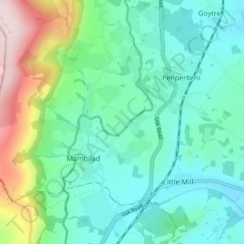
Name: Croes-y-pant topographic map, elevation, terrain.
Location: Croes-y-pant, Monmouthshire, Wales, NP4 8RE, United Kingdom (51.71134 -3.01697 51.75134 -2.97697)
Average elevation: 148 m
Minimum elevation: 50 m
Maximum elevation: 449 m