
Ain Sefra topographic map
Interactive map
Click on the map to display elevation.
About this map
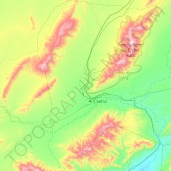
Name: Ain Sefra topographic map, elevation, terrain.
Location: Ain Sefra, Ain Sefra District, Naâma, 45200, Algeria (32.56876 -0.77096 33.02796 -0.38731)
Average elevation: 1,287 m
Minimum elevation: 896 m
Maximum elevation: 2,232 m