
Auweiler topographic map
Interactive map
Click on the map to display elevation.
About this map
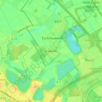
Name: Auweiler topographic map, elevation, terrain.
Location: Auweiler, Köln, Nordrhein-Westfalen, 50765, Deutschland (50.98205 6.83259 51.02205 6.87259)
Average elevation: 48 m
Minimum elevation: 36 m
Maximum elevation: 60 m