
Sedrata topographic map
Interactive map
Click on the map to display elevation.
About this map
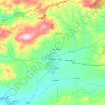
Name: Sedrata topographic map, elevation, terrain.
Location: Sedrata, Sedrata District, Souk Ahras, 41200, Algeria (36.05801 7.44653 36.23535 7.65036)
Average elevation: 937 m
Minimum elevation: 734 m
Maximum elevation: 1,422 m