
Bonnal topographic map
Interactive map
Click on the map to display elevation.
About this map
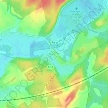
Name: Bonnal topographic map, elevation, terrain.
Average elevation: 271 m
Minimum elevation: 247 m
Maximum elevation: 310 m
Bonnal liegt auf einer Höhe von 265 m über dem Meeresspiegel, drei Kilometer nördlich von Rougemont und etwa 31 km westlich der Stadt Montbéliard (Luftlinie). Das Dorf erstreckt sich am südlichen Ufer des Ognon nahe der Mündung des Ruisseau de l’Étang.