Geolocate

Herstmonceux topographic map

Click on the map to display elevation.

About this map

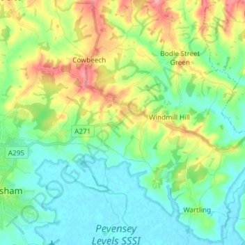
Name: Herstmonceux topographic map, elevation, terrain.

Location: Herstmonceux, Wealden, East Sussex, England, United Kingdom (50.84774 0.27920 50.92458 0.35072)

Average elevation: 28 m

Minimum elevation: -1 m

Maximum elevation: 88 m

East Sussex trails, hiking, mountain biking, running and outdoor activities

Gear up for your next adventure:

🥄Titanium Camping Sporks - The ultimate lightweight utensil for trail meals
🔪Outdoor Multi-Tools - Versatile tools for gear repairs and food prep in the wild
🌄Compact Monoculars - Lightweight optics for hiking
🥤Collapsible Water Bottles - Save space in your rucksack as you consume your water
🥾Hiking Boot Waterproofing Wax - Maintain the lifespan of your leather trekking boots

As an Amazon Associate, this site earns from qualifying purchases at no extra cost to you.