
Make a donation
Gear up for your next adventure:
As an Amazon Associate, this site earns from qualifying purchases at no extra cost to you.
Mani topographic map
Click on the map to display elevation.
Make a donation
Gear up for your next adventure:
As an Amazon Associate, this site earns from qualifying purchases at no extra cost to you.
Mani
Mani (Greek: Μάνη) is a village and a community in the municipality of Didymoteicho in the Evros regional unit, Greece. It is situated near the left bank of the river Erythropotamos, 2 km west of Karoti, 4 km northeast of Kyani and 10 km northwest of Didymoteicho town centre. In 2021 its population was 364 for the community, which includes the villages Evgeniko and Sitaria. Its elevation is 55 m. The current town of Mani was founded by Maniot Greeks who fought under the King of Greece against the Republic of Turkey and Kemal Atatürk during the 1920s.
Make a donation
Gear up for your next adventure:
As an Amazon Associate, this site earns from qualifying purchases at no extra cost to you.
About this map
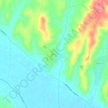
Name: Mani topographic map, elevation, terrain.
Average elevation: 53 m
Minimum elevation: 23 m
Maximum elevation: 128 m
Make a donation
Gear up for your next adventure:
As an Amazon Associate, this site earns from qualifying purchases at no extra cost to you.